A Great Walk is a formal classification for nine treks in New Zealand, and I’ve set myself the goal of completing them all.
So I was keen to get this second Great Walk under my tramping boots, having walked The Heaphy Track several years earlier.
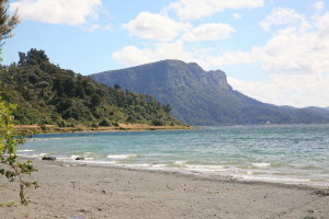
Lake Waikaremoana in the Maori language, means sea of rippling waters and the Lake region is steeped in Maori legend, nomenclature, sacred sites and history, ancient and modern.
Lake Waikaremoana is also a place of natural beauty that you can enjoy whether or not you’re a tramper, bushwalker, rambler, hiker or trekker.
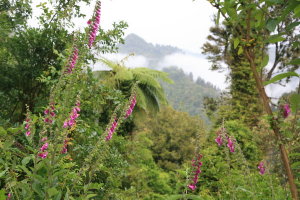
The Lake was originally formed by a landslide around 2,200 years ago, but the level dropped five metres to its present level in 1946, when a hydro electric project was undertaken. Like many parts of New Zealand, the natural heritage of the area has suffered from introduced species, from foxgloves to deer.
The Great Walk is 46 kilometres long and begins at lake level, 614 metres above sea level. Over three days, I climbed to 1,180 metres above sea level at Panekiri Hut. I tramped this distance over 3 days and 2 nights, but if you’re new at this kind of venture, I’d recommend you spend 4 days and three nights.
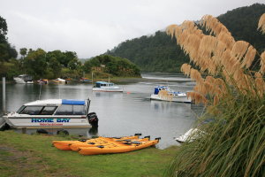
While the walk pretty much circumnavigates the lake, there is a stretch that isn’t part of the trek, so a water taxi can take you from the Lake Waikaremoana Motor Camp to Hopuruahine Landing.
From there its a 2 km walk from the start of the track at Hopuruahine Suspension Bridge.
That’s how we started Day 1, with an afternoon walk of about 10 km, following river flats along the Hopuruahine River, before following the shore along Whanganui Inlet to Waiharuru Hut. We pitched our tents in the rain, cooking and sheltering that evening in one of the Maori-style cooking huts built around the lake for trampers.
Day 2 was more of a challenge for me. My backpack was overloaded, it was still raining, it was a little cold, the track was muddy and there were a few saddles to climb between the flatter sections along the lakeside. The distance to be covered was already 18 km so I decided to skip the side trip to Korokoro Falls.
Happily, Marauiti campsite was absolutely delightful, with its beach, pampas grass and black swans, and the chance for a refreshing swim in the lake. On Day 3 we left our packs on the beach for a pre-arranged boat pick-up later that day. It was pretty important to offload our backpacks, as that day we had 16.5 km to walk, involving a climb over Panekiri Bluff. It was a beautiful walk, through mossy forests of beech, podocarp and kamahi trees, a myriad of ferns and fungus, and secretive but audible birdlife.
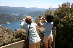
But it was a climb, though the panorama from Panekiri Hut, 1,180 metres above sea level, was stunning and an ample reward for the climb. The descent, varying from undulating to steep, took us back to the old military station of Redoubt, where once again, a very welcome pre-arranged water taxi took us back across the lake to the motor camp.
I arrived, exhausted, but oh so happy to have completed the Lake Waikaremoana Track. (I agree with the Department of Conservations description of this Great Walk as moderately easy, and the emphasis it puts on the importance of fitness and good equipment.)
My visit was beautifully organised by a fellow walker from Melbourne Bushwalking Club but there are also commercially available guided walks, for example, by Walking Legends.
Lake Waikaremoana is a destination well worth the 160 km journey from the thermal region of Rotorua, or the 191 km journey from art-deco-rich Napier. Most visitors do walks of 1 day or less, or go kayaking, fishing or boating. Or they just cruise!
I recommend that you cruise along to Lake Waikaremoana too. And if you can, walk this Great Walk!

